


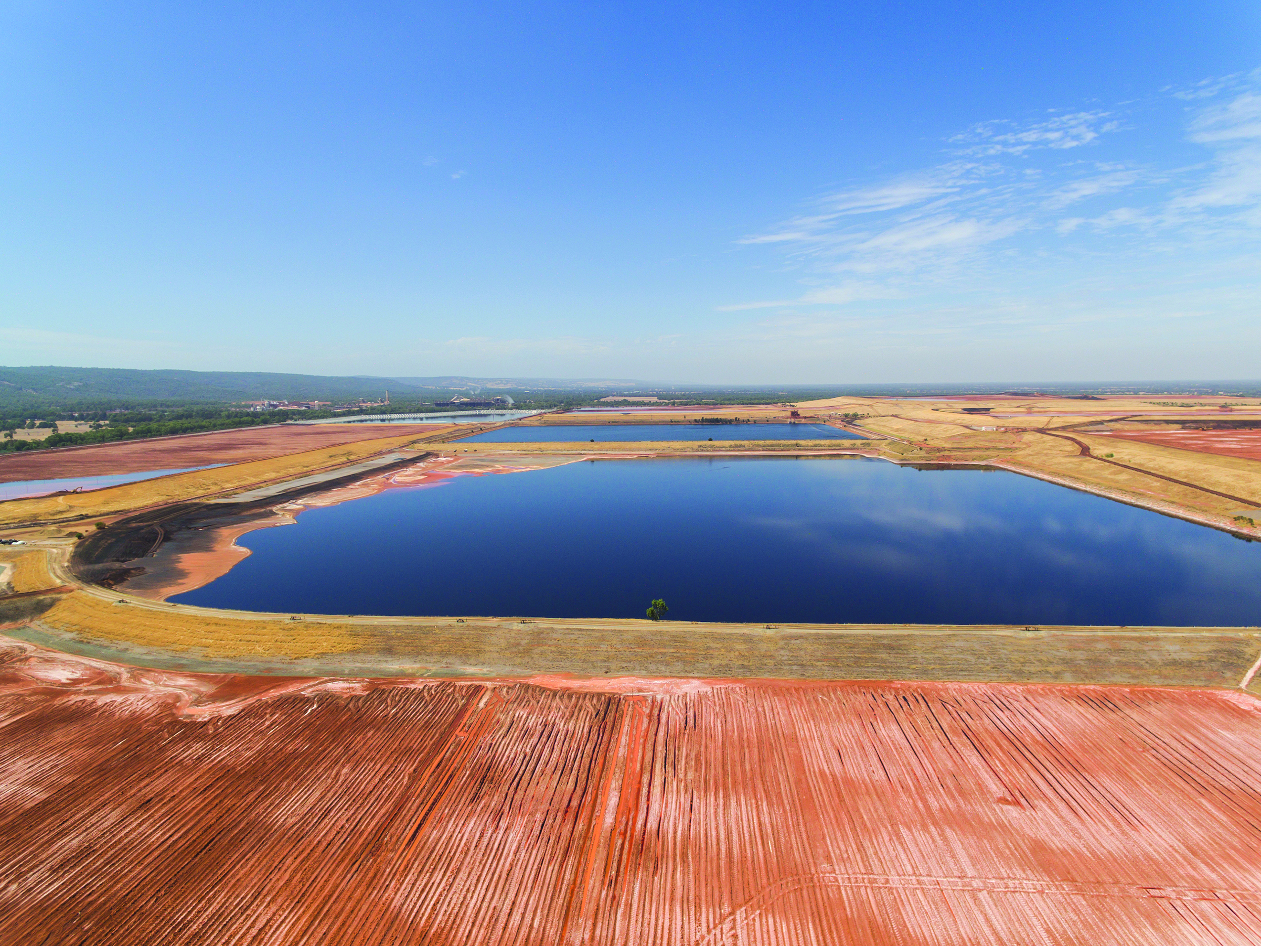
Various research projects are under way into appropriate tailings storage facility design and management, including a review by the ICMM and a project led by AMIRA. (Photo: Inmarsat)
Change is afoot for tailings dam operators. E&MJ looks at how digital monitoring solutions can help address the issue of safety
By Carly Leonida, European Editor
Tailings management is a hot topic at the moment, and rightly so. The dam collapse in Brumadinho, Brazil, in January and the subsequent media coverage surrounding the event shone light on an area of the mining industry that had seemingly been swept under the rug. The shockwaves this created are still being felt today.
Talk of tailings dams has dominated virtually every mining conference so far this year. The Global Mining Guidelines Group took a poll at its booth at the annual Society for Mining, Metallurgy and Exploration (SME) meeting in Denver in February. Visitors voted for topics they thought were a priority for the industry to address. The topic that received the most votes was, unsurprisingly, tailings dams.
Dr. Penny Stewart of PETRA Data Science reported similar findings after running a workshop on machine learning in Brisbane recently. Participants at the event voted for topics that presented the most compelling business case for the application of machine learning, and the prediction of tailings dam failures came out on top. The company subsequently published a blog post on its website looking at the applicability of machine learning in this context.
“Everyone in the industry was deeply affected by what happened [at Brumadinho],” Stewart told E&MJ. “I really felt I needed to do something with the workshop outcome. Hopefully it [the article] helps people think about collaboration and integrated data solutions for tailings dams.”
Stewart is right. The sense of responsibility felt throughout the industry on this topic is incredibly strong, and the level of interest shown is unlikely to abate. In fact, it is more likely to increase as various research projects into appropriate tailings storage facility (TSF) design and management methods come to fruition later this year.
Establishing Standards
On March 27, the International Council on Mining and Metals (ICMM), the United Nations Environment Programme (UNEP) and the Principles for Responsible Investment (PRI) announced they would conduct a global review to establish an international standard for the safe management of TSFs.
The review, which is currently under way, will evaluate good practices in TSF design, monitoring and management as well as lessons learned from multiple tailings dam failures.
On the website dedicated to the review, the ICMM stated it will be considering governance options to ensure compliance with the standard.
This will be vital to the success of the initiative. Following the Samarco dam collapse in 2016, the ICMM conducted a similar review and published a report that detailed necessary improvements in TSF management.
In the press release accompanying it, the organization said, “ICMM’s Tailings Governance Framework is embedded in a binding CEO-led position statement. Its purpose is to enable enhanced focus on those key elements of management and governance necessary to prevent catastrophic failures of TSFs. It also commits members to the continuous improvement in the design, construction and operation of TSFs.”
One would therefore expect ICMM’s members to be on top of their dam management programs. However, following the Brumadinho collapse in January (Vale, which owns the mine, is an ICMM member), the Church of England Pensions Board and the Council on Ethics of the Swedish National Pension Funds wrote to 683 extractive companies, including ICMM’s 26 members, asking them to disclose the status of their TSFs. Many responded, and the results were eye opening with a number of facilities declared as potentially risky.
It is clear then that better governance and clarity on how mining companies will be held accountable if their facilities are found to be lacking are required.
A concern of many industry experts is that any standards imposed upon mines could be too prescriptive. However, failure of the industry to self-govern in the wake of earlier events, like Samarco and Mount Polley and, given how high-profile the issue of tailings dam management has become, if miners wish to maintain their social license to operate they will have to comply with the rules that are now proposed.
A first draft of the report is expected in August, with a final copy due by year end, and the ICMM put out a call on June 13 for vendor engagement to help strengthen its research into the monitoring and surveillance of tailings dams.
Talking Technologies
AMIRA International, a member-based organization of minerals companies and suppliers, is also looking into TSF monitoring technologies. The group organized a workshop for its stakeholders on June 24, at Rio Tinto’s office in Perth, bringing together senior representatives from 23 companies, comprising 16 producers and seven METS companies.
The aim was to validate the initial concept of AMIRA’s P1217 Evaluation of TSF monitoring technologies project.
The project is in the early stages — the team is still working to finalize the scope — but told E&MJ they would be ready to release further details in a few months.
Until groups like AMIRA and the ICMM are ready to disclose further details of their work, miners would be wise to conduct their own research into suitable TSF monitoring solutions. As with so many issues in mining, a proactive approach is preferable to a reactive one.
Maptek, which signed an agreement with PETRA Data Science in March this year to integrate the companies’ solutions, is active in the TSF monitoring space. Its Sentry package combines a laser scanner with software to monitor, analyze and report on ground movements that have the potential to cause dam failures. Sentry can be deployed in various configurations, including a mobile system containing a laser scanner mount, power and communications modules, as well as cellular and Wi-Fi networking.
Users can customize monitoring frequency and thresholds to meet strategic design and operational planning needs, as well as generate reports for geotech-
nical teams and management to help manage risk.
“We recommend scanning set to a resolution that allows a large amount of data to be captured in around three minutes,” James Howarth, product manager at Maptek, told E&MJ. “Tailings failures can happen fast, so fast scan times are needed for detection. Alarms are typically set on a combination of velocity and total cumulative displacement.
“Some logic may also be applied to alarms, which can be emailed and or texted to key personnel. This can also be added to SCADA systems if required for direct reaction in mine control room systems.”
Maptek also offers advanced sensor technologies coupled with its PointStudio software that can be used to detect change in different environments. The system relies on data from a terrestrial laser scanner to create a high-definition digital terrain model, and versions are compared on a regular basis (weekly) to create a heat map and analysis of the area of deformation.
Once an area of change is identified, continuous monitoring systems can be engaged to cover the area at risk.
“Maptek collects survey-grade spatial data to create a high-definition point cloud and integrated, colored photographic surfaces,” Howarth explained.
“The individual points are measured by PointStudio deformation applications, or processed into cells and measured by the Sentry monitoring package,” he added. “The same data can be used across all of Maptek’s measurement software for many different applications.”
From Land to Sky
Another company heavily involved in TSF monitoring is TRE Altamira. The company’s platform provides an online webGIS service where surface displacement results are updated to identify changes in stability over time. The primary objective is to identify any accelerations in movement trends that may indicate precursor motion prior to a potential failure. The data is provided through an online platform where interferometric synthetic-aperture radar (InSAR) results are visualized over Bing Maps with optical imagery obtained from other sources.
Jessica Morgan, technical sales representative and country manager for Australia and New Zealand, told E&MJ: “The information we provide consists primarily of a point cloud of individual measurements of surface displacement over time, typically color-coded by their velocity of displacement (in mm/y).
“Each point has an individual time series of displacement, along with an associated standard deviation value or confidence limit. The platform also contains tools for interrogation and analysis of the results obtained over tailings dams.”
Data is automatically uploaded on to TRE Altamira’s online platform with respect to a monitoring plan defined in partnership with the end user. Updated results can be provided on a weekly, monthly or yearly basis, and downloaded in a format dictated by the end-user for subsequent upload into any other monitoring software or GIS platform.
With InSAR data, updates are limited to each new image acquisition (which is weekly at best), so InSAR monitoring is not a real-time monitoring system like ground-based instruments such as prism networks or ground-based radar systems.
“We view InSAR technology as a longer-term monitoring approach to warn sites where a potential instability may be developing over time, with the primary aim to focus monitoring efforts at specific locations where they are most needed,” said Davide Colombo, customer solutions specialist at TRE Altamira. “In this regard, InSAR is viewed as a significant and substantial piece of an integrated global monitoring solution.”
Learning to Predict Failures
Descartes Labs is also planning to use InSAR data in tailings dam monitoring. The company has developed a unique digital infrastructure platform for machine learning workflows and predictive modeling.
“The core of our platform is a data refinery, which combines geospatial data (satellites, aerial, drones, cameras, etc.), with our client’s proprietary geophysical data (gravity, magnetics, radiometric, geochemistry, etc.). This refinery cleans, normalizes and stores disparate datasets so they can be used to create models of the physical world,” James Orsulak, senior director at Descartes Labs, explained.
The system is backed by one of the world’s fastest cloud-based supercomputers, enabling rapid experimentation, iteration and scale. Descartes’ infrastructure is mated to a service offering, which involves forward-deployed PhD-level applied scientists and engineers who ensure clients can maximize the power of the platform.
Orsulak explained: “In the mining industry, the final output of our work takes many forms: from increasing the speed of geoscience and mineral targeting workflows, to demand factor modeling and price predictions, to improving the safety of tailings dams. Our engagement model focuses on identifying the most valuable use-cases for a machine-learning platform of this scale, and then implementing those ideas one-by-one.”
Descartes is currently conducting a first-principles scientific assessment of all major data modalities and their ability to monitor tailings dams for deformation and changes. This includes a detailed evaluation of recent tailings dam failures.
“This is not a single project, but rather an aggregate of many projects,” Orsulak said. “We have the ability to monitor all of the worlds tailings dam from space right now, and we will begin releasing results of that work in the next few months.”
He added though that space-based monitoring is just one piece of the puzzle.
“The real paradigm shift involves ingesting and fusing multiple data feeds, ground truth, etc. into a single digital model of the dam that can be monitored for changes and anomalies. When we combine these dynamic models with information on historic failure modes and construction methodologies, we can finally begin to make real progress on improving tailings dam safety,” he said.
Synthetic aperture radar (SAR) is distinct in two ways. First, it actively emits a signal and forms images by processing echoes that return from the area of interest (AOI). Consequently, it doesn’t require the target to be illuminated by the sun, as do most optical sensors. Further, the signal used by SAR systems penetrates clouds. This allows data collection to occur regardless of time of day or weather.
The second distinction is that SAR is a coherent imaging technology. This means that the emitted and returned signal consists of an electromagnetic wave, where the phase within the wave can be sensed. This provides significant additional information which allows measurement of deformation. For the analysis at hand, only SAR, with its coherent phase, allows Descartes to make the required measurements.
Orsulak said a single SAR collection has a resolution of 15 meters for freely available data, and a meter or less for commercial data.
“With regard to deformation measurements obtained with phase information, accuracy depends almost entirely on the volume of data used — repeated SAR collections over the same area allows one to separate properties of the AOI from phase noise,” he told E&MJ.
“Ancillary data, such as an estimate of elevation, and precise orbit positioning data also contribute to the accuracy of the measurement. Quantitatively, using a shallow stack of SAR collections, a rough estimate of relative deformation between points a few hundred meters apart, can be accurate to 10 cm. A careful analysis of a deep stack of SAR collections, can achieve accuracy to within a few millimeters.”
Caring and Sharing
The Descartes platform will also incorporate aerial and drone data, piezometers, seismic data, and data from on-site cameras, radar and slope monitors to ensure its tailings dam predictions are as accurate as possible.
“We are data agnostic in our assessments and are actively looking for new solutions to this problem. We also believe these models will help inform improvements and changes to tailings dam construction that have not been considered previously,” Orsulak added.
When available, historic datasets will also be utilized.
“We develop models that measure physical phenomena with limited ground truth, and models that are trained on extensive historical data. Models can also be a combination of these two methods,” Orsulak said.
“Data quality is a common problem. Our platform is designed to rapidly clean and normalize different types of data for modeling workflows. We have an entire team dedicated solely to data ingestion and cleaning.”
Descartes may have a unique solution but, like the other companies interviewed for this article, it is keen to share the results of its work for the greater good.
“Safety is not a unique competitive advantage; it is an industry wide responsibility and something we take incredibly seriously in the mining industry,” Orsulak said. “It transcends companies and profits. The more participants we have in this project, the more impactful and successful it will be. Zero fatalities from tailings-related failures is an achievable goal.”
Collaborate and Innovate
Satellite operator and communications specialist, Inmarsat, also branched into tailings dam monitoring earlier this year. The company announced in February that it had joined forces with mining consultancy Knight Piésold to offer a new IoT-based solution for this space.
“In 2017, we sat down with Knight Piésold and one of its customers to discuss the issue of managing tailings dams,” Joe Carr, director of mining innovation at Inmarsat, told E&MJ. “And not just, how to manage a single dam, but a portfolio of dams spread around the world, all with different processes and methods for collecting and storing data.
“How do we create a global, standardized, governance system for tailing safety and audit purposes? That’s really where we began.”
Inmarsat spoke to a number of mining companies to better understand the challenges it was facing and set to work developing a solution. In February, the fruits of its labor were ready for market.
The Inmarsat system collects data from a range of industry-standard sensors, such as piezometers, via edge connectivity before transferring it across Inmarsat’s L-band satellite network to a single cloud dashboard. This enables mining companies and regulators to view the status of their dams with metrics such as pond elevation, piezometric pressures, inclinometer readings and weather conditions displayed in one place, no matter where the mine is located. The solution is sensor-agnostic so will work with both existing sensors and new devices. An auditor such as Knight Piésold then provides expertise to help companies interpret the data and implement an effective TSF management plan.
Carr explained: “There are many different types and brands of piezometers, but most of them have an electrical output. Our technical guys looked at how we could take that analogue output and digitize it at the edge, on the dam, for each sensor.
“We have essentially made them ‘smart,’ so they can broadcast using a long range wide-area network (LoRaWAN). Then we built an aggregation box that sits on the dam and that has the LoRaWAN base station, and also the Inmarsat L-band base station.
“We pool the data at the edge and broadcast it over the system. The box has its own battery and solar panel, so it’s stand-alone. It requires no physical infrastructure beyond a concrete pad.”
This is an important feature, because many mine sites are closed.
“I’d say the greatest benefit is on the closed sites,” said Carr. “With closed sites, you’ve got to drive for several hours to get there. But with our system, you get readings automatically.”
Data flows across Inmarsat’s network, which is private and secured end-to-end. It is aggregated in a cloud dashboard, and users can access it in real-time and establish customized alarms and audit trails.
“This is where working with an auditor like Knight Piésold is really essential,” Carr said. “Because you can look at it and say ‘well, if something happens to my piezometric pressure, I want an alarm. And if nobody actions that alarm, then it needs to go the next person.’ And so forth. The aim was to remove human error. The alarm system and hierarchy of escalation means that you won’t miss alarms.”
Carr said Inmarsat has had an interesting response to the system. Not just from mining companies, but also from insurance companies, regulators, investors and industry bodies.
The company recently signed a memorandum of understanding (MoU) with Minas Gerais state government in Brazil to look at how its remote-monitoring solution could help to assess and monitor tailings dams in the region.
Carr said that in the long term, data collected through Inmarsat’s system could be used to aid dam design and construction.
“There has never been a way to compare different dam structures globally,” he said. “With a system like ours, which can pull data from hundreds of dams, we have the ability to say ‘upstream dams in this region perform this way. And downstream dams in this region perform this way.’ But our focus to begin with is purely, how do we improve on-site operations of existing dams?”
Time for Action
Carr summed up the gist of this article perfectly: “Two or three years ago, people wouldn’t have talked about tailings dams. It was the bottom of the agenda,” he said. “If you talk to a CEO now, it’s one of the first things they want to talk about, because investors really care today.
“We have a social license to operate that is at risk. We’ve done so much great work over the last decade on zero harm and reducing injury rates on-site. You can see that with accident rates decreasing, but if you look at tailings dam failure rates, they’re actually increasing.
“The question is how does the industry standardize and bring everyone up to the same high level? And how do we hold companies to account? We need a public register, we need a public body, we need a globally recognized industry standard way to monitor. And we need companies to deliver services that support that.”


