


A satellite-based monitoring system is adopted for use in monitoring Nord Gold’s 1,100-km2 Lefa mine in Guinea. (Photo: Nord Gold)
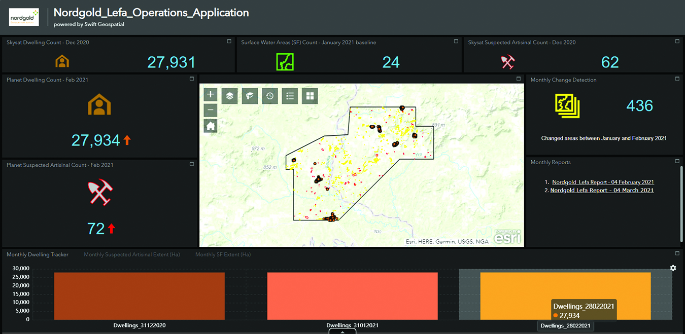
Nord Gold deployed a satellite-based monitoring system by Swift Geospatial Solutions at the Lefa mine in Guinea. The system uses imagery processing algorithms to proactively identify risks at the mine’s tailings storage facilities.
The system serves other purposes. It is used to monitor “community welfare by tracking community dynamics, including house building,” Nord Gold reported. It is also used to monitor artisanal mining activities near the 1,100-km2 mine.
The system uses artificial intelligence, gives regular updates, and presents deliverables on a web-based dashboard.
Nord Gold said it is pleased with the system. “It will help us to receive timely and relevant information about the condition of Lefa’s critical environmental infrastructure and the mine’s immediate surroundings,” Evgeny Tulubensky, chief legal officer, Nord Gold, said. “Using this rich data, our aim is to continue reducing our impact on the natural environment and ensuring sustainable development of local communities.”


